ROCK RECORDS
Decoding Earth’s past to de-risk your future
About us
Rock Records provides specialist geological consulting focused on structural geology, tectonic analysis, and the integration of complex geoscientific data for decision-making in exploration, environmental, and engineering contexts.
Services combine expert geological interpretation through data integration, spatial analysis and modelling, delivered through targeted consulting engagements and reusable attributed geological data products.
Rock Records is led by Dr Lloyd White, who brings over 20 years of experience in applied research and exploration for global mining and energy companies, together with more than a decade of university teaching and training of geoscience professionals.
Whether you are advancing an exploration, construction, or environmental project, Rock Records provides clear geological insight and defensible interpretation to support confident decision-making.
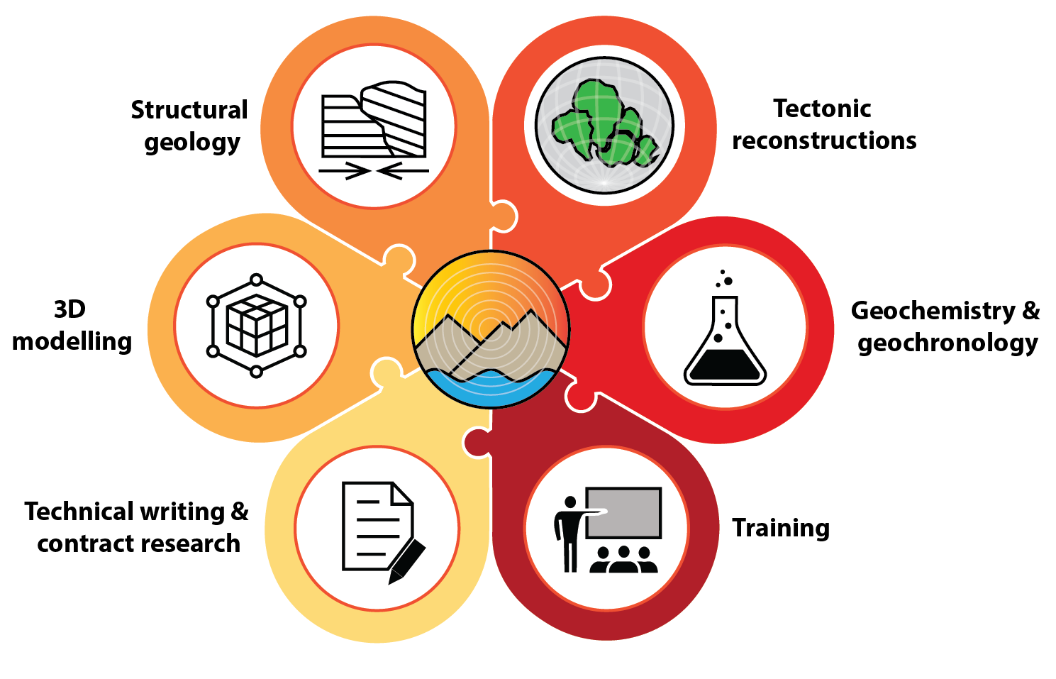
Consulting Services
-

Structural Geology & Tectonic Analysis
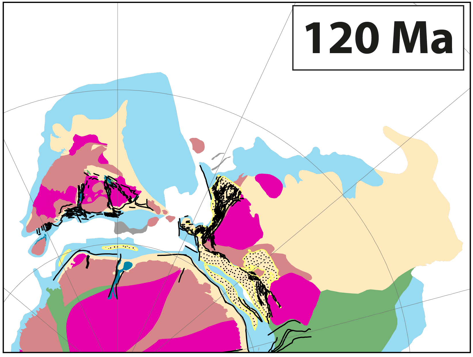
Structural geology underpins mineral systems, subsurface architecture, and geotechnical risk. We provide structural interpretation ranging from continental- to tenement scale, and informed by field experience across Australia, SE Asia, India, USA and UK, combined with a background in geochemistry, geochronology and geophysical image interpretation.
Services Include:
- Fault and shear zone characterisation
- Deformation histories of multiply deformed sequences to establish structural controls on mineralisation.
- Tectonic reconstructions to restore your data through time to explore how the stress field evolved, and where similar structural traps or mineralisation patterns might occur.
-
Attributed Geological Datasets
We develop expert-attributed geological and geospatial datasets that encode geological interpretation into structured, machine-readable formats suitable for analysis, modelling, and reuse.
These datasets go beyond traditional maps by explicitly capturing geological meaning – such as structural hierarchy, kinematics, timing, and spatial relationships – with documented provenance and uncertainty. Products may be delivered as region-scale datasets, or licensed area-of-interest extracts.
Applications include mineral system analysis, regional screening, and subsurface modelling.
-

Bespoke Geological studies and Desktop Research
Targeted geological studies are undertaken where focused interpretation is required to inform exploration strategy, project development, or regional understanding.
This may include:
- Regional synthesis and concept development
- Mineral systems analysis
- Integration of legacy datasets and reports
- Independent technical reviews
Desktop studies are approached as analytical products, not literature summaries, and frequently form the foundation for datasets, models, or longer-term decision support.
-
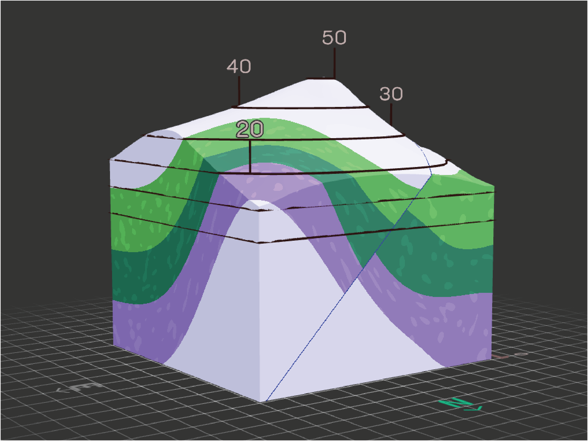
3D Geological and Subsurface Modelling
Three-dimensional geological modelling is used to integrate field, structural, drill hole, assay and geophysical data.
Models may be developed to:
- Support exploration targeting
- Assess structural and stratigraphic controls
- Communicate geological uncertainty
- Provide a framework for further analysis or simulation
Modelling workflows are designed to be transparent, geologically defensible and fit for purpose.
-
Geospatial Analysis
We bring deep experience in geospatial analysis, data creation, and custom scripting to help you map, visualise, and interrogate your data, revealing insights that standard approaches often miss.
We have experience with ESRI applications (ArcMap/Pro, StoryMaps, FieldMaps, Dashboards), QGIS and other 3D mapping software (e.g., Leapfrog, MOVE, GoCAD).
-
Training, Technical Advice and Collaboration
We provide technical advice, mentoring, and training tailored to geological teams, researchers, and organisations seeking to strengthen their structural, spatial or integrative capabilities.
This includes:
- Short courses and targeted training
- Advisory roles on complex geological problems
- Collaboration on research and data-driven projects.
Engagements can be structured as short-term advice or longer-term technical support.
Contact us
Rock Records works with clients across Australia and internationally, with a focus on delivering clear geological reasoning, defensible interpretations, and practical outcomes.
Please get in touch to discuss consulting services, dataset availability, or collaborative opportunities.